| This document in the Internet: www.bielefeldt.de/denalie.htm |
Home |
Back to "Mountains" |
Back to Expeditions |
Map sketch |
Height diagram |
Info Denali |
Part 2: Alaska |
Deutsche Version |
 Slideshow |
print version (no menus) |
Our Alaska 2000 trip report is divided into two parts. Part 1 contains the mountaineering expedition to Denali, and part 2 contains our following trip through Alaska. The same applies to the corresponding "practical hints" pages.
| Quick overview - mountains | |
| Denali (Mt. McKinley) | 6193 m |
| (West Buttress; Kahiltna Glacier - summit in 9 days) | |
Denali (Mt. McKinley), Alaska (6193 m)
May 12 - June 11, 2000
Claudia Bäumler and Hartmut BielefeldtPart 1: Expedition to Denali, May 12-29, 2000
Author of this text: Hartmut Bielefeldt
Friday, May 12, 2000
Flight Frankfurt - Las Vegas - Seattle - AnchorageAfter an 11 hour flight we arrive in Las Vegas at 2 pm local time. It's obvious where we are, there is only desert around a rather small city, and the whole airport is full of gambling machines. At 7 pm we continue on to Seattle. The view of Mount Rainier, dominating the whole region, is very impressive. From there, finally, at 10 pm we begin the last leg of our journey and reach Anchorage at 1 am after a long flight over endless uninhabited, snowy landscapes. Around 2 am, this 31 hour day finally reaches its end at a hostel in Anchorage.
Saturday, May 13, 2000
AnchorageSaturday is used to complete our food supplies for our time at the mountain, to get a general orientation of the area, and to compensate for 10 hours of jet-lag. In the supermarket, we quickly encounter two problems: First, you hardly get anything in amounts that would be suitable for a traveler. What shall we do with 24 cans of lemonade, which we only bought because it was cheaper than a package of 12? Many things are hardly found in amounts smaller than a pound. Our second problem is the prices here in Alaska. Fruit and vegetables are, of course, the price leaders - but also quite normal food is more expensive than even a 1:1 ratio from DM to US$: The numbers we read on the price labels in US$ are generally 10 to 20% higher than the prices we usually pay in Germany in DM!
The weather in sunny, but rather fresh, during the day around 10-13°C. The vegetation has come as far as it was at home two months ago. As I have an allergy to birch trees, I am sure I won't stop sneezing for the next few days at least.
The city area of Anchorage is rather widespread, and it takes us more than an hour on foot to reach what may be called downtown. Everwhere the snow-covered mountains appear to be quite close and give Anchorage an interesting character. From the small resolution park, the Aleutian range (the western continuation of Alaska range) can be seen over the sea arm. Mount Susitna, 50 km away, looks like one could almost touch it, the more distant 3000 m peaks are partly obscured by a milky haze.
Sunday, May 14, 2000
AnchorageWe have rented bicycles at the hostel in order to look around the Anchorage area today. Unfortunately it is cloudy with a little drizzle. As mentioned, Anchorage occupies a rather large area. Basically, most of the city consists of single houses standing in the woods. The main streets usually follow the quadratic survey mesh in distances of a mile, without any consideration of topography that might not follow this mesh.
Along the streets, one finds traffic signs warning motorists and bicyclists of moose - definitely not a joke, the moose really exist, standing on the bike paths and nibbling at trees and bushes.
We are heading for the mountains nearby today. After we have fought our way up to about 700 m altitude at the edge of Chugach State Park, we encounter slight snowfall. Nevertheless, the view over Anchorage from the Glen Alps View Point is quite interesting. The trail to Flattop Mountain that we originally had considered is still closed, and seeing the masses of snow, an attempt would probably not be the best idea with our light trekking boots. By the way, the parking lot at the trailhead, barely within the park boundary, costs the luxury of $5 per day.
Monday, May 15, 2000
Anchorage - Talkeetna - Base Camp (van/airplane)Exactly on time at half past seven in the morning, the van arrives for our trip to Talkeetna. After an hour or so all passengers and their luggage are collected from different locations all over the city. The highway has four lanes from Anchorage to the junction of Glenn highway, and traffic is considerable. Astonishing, since there is only woodland around. At second glance, however, we find scattered villages all the way to Wasilla. Willow, for example, is not visible at all from the highway.
Talkeetna is at the end of a 14 mile dead end road. Although only hundred meters above sea level, there is still snow in all shady corners. The Alaska Talkeetna Lodge on the hill above the village indicates that here the mass tourists with their fat purses have also arrived. (We won't stay there.)
The registration at the ranger station is done in 45 minutes, and at about 3 pm the airplane is prepared for the flight. Seats are removed or rearranged, the pilot loads baggage and equipment into the plane, according to weight. Finally the two of us get in, too. The flight crosses the wide swampy lowlands of the Susitna valley. Now there's still snow here, but after the snow melts, there will hardly be a way through here. After some hills with the tounges of the long valley glaciers in between, the scenery soon becomes more dramatic. Unfortunately, today the weather is also cloudy, there is not much of an upwards view. Correspondingly, the pilot cancels the approach to the cloud-covered pass and takes a route further outside, passing mountains called Trolls and Crown which tower the glaciers as impressive as the names imply. After about half an hour we arrive at the base camp on Southeast Fork Kahiltna Glacier, at an altitude of 2200 m. Base camp manager Annie immediately welcomes us and gives fuel and sleds. We find an existing hole 1 m deep as a site, and after a little sideways enlargement the tent fits in nicely, well protected from possible storms.
The afternoon is cloudy with some sun; later it becomes overcast, a little snowfall sets in. It is not too cold, in the sun even quite warm.
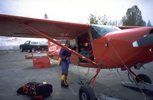
Loading the airplane is a real science.
Tuesday, May 16, 2000
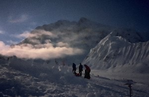
Morning at basecamp, in the background Mount Hunter.
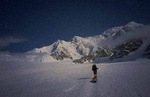
The long way along Kahiltna glacier
Not a cloud in the sky - now we can finally see all the scenery around us. Appears very arctic, below us the huge Kahiltna glacier, and around it there are heavily glaciated mountains with crazy cornice crests. Mount Hunter directly above the base camp looks especially unfriendly.
Our way for today, however, is as easy as it could be, at least technically. At a quarter past nine we have finished packing all the equipment and go down the glacier arm to the main stream of Kahiltna Glacier. With the sleds behind us, going down is quite different to what we are used to. Until the "Medical Camp" at 4300 m, typically reached after 5 days, one has to take clothes, food and fuel for a possibly longer period, depending on the weather. Food for three weeks, two tents and of course the warmest possible clothing make up a load of about 40 kg for each of us.
Fortunately, the way until below Ski Hill is quite flat, and the sled is easily pulled. For a distance of 12 km, the altitude gain is only 400 m. But there is a nice view to Windy Corner and the regions above Medical Camp.
At Ski Hill the glacier becomes steeper, and the weight of the backpack and the sled becomes noticeable. After an hour it's enough for today, at 2600 m we pitch our tent. The snow wall is finished after an hour.
During the day, clouds came partly from above, partly a cloud layer from down the valley rose upwards. The sun still penetrates the clouds, and the afternoon is dreadfully hot. Later the clouds become more dense, forming a strange fog and releasing some snowflakes.
Wednesday, May 17, 2000
Ski Hill - Camp 11000'The temperature rises more quickly than yesterday, but the weather is not so nice. A tenacious foggy cloud layer oftens gives us no more than hundred meters of sight. Fortunately the way is well marked and - without fresh snow - hard to miss anyway.
Soon the rest of Ski Hill is done, and the valley becomes flat again. After four hours - an American guide tells me that we are close to Kahiltna Pass, visibility is almost zero - it becomes steeper."Motorcycle Hill" is quite a task with the sleds, even if it is only 200 meters high.
Meanwhile visibility is better and we can escape the foggy soup from time to time. Camp 11000' is situated behind a small ridge at 3350 m; above we see the huge West Buttress under which we will make our first trip to Windy Corner tomorrow. The name of the camp originates from its height of 11000 feet, in lack of other significant features here.
Setting up the camp takes longer today; the snow walls should be more solid at higher altitude, and the snow here is not as good as at Ski Hill.
Tomorrow we will continue without skis and sleds. Up above there are some traverses where pulling a sled loaded with 20 kg wouldn't be good for our walking comfort. According to the rangers' explanations the snow is blown away in that region, so there would be no benefit from the skis. And the weight of the skis is not negligible.
Anyway, the boring long hike through the flat valley should be over now, and we should gain altitude at a quicker pace.
At 3350 m it is colder than it was down yesterday. At 8 pm we find -13°C, and this is still in the middle of the afternoon. Because of the clouds, we haven't found out yet at what time the sun sets. It doesn't become really dark at night, at the darkest time the light is such that it's just a little too dim to read.
Thursday, May 18, 2000
Camp 11000' - Depot auf 3700 m - Camp 11000'Since yesterday evening, more and more wind is whipping up, throwing snow at our tent. Here and there it is snowing. This morning, a milky sun looks down from the sky, it is not too cold (-15°C), but the wind is very annoying.
Like most of the other groups, we set off for our first carry to Medical Camp. Soon the wind increases, and the sun disappears - as well as our surroundings do. At 3700 m we set up a cache in the lee of a snow crest and turn back. Hopefully the weather will be better tomorrow. Going down, we hardly see our way because of the snow blowing onto our glasses and immediately freezing there.
Friday, 19. May 19, 2000
Camp 11000' - Windy Corner - Medical Camp and backWhat a change a day can make! The morning is sunny and calm. After 1 1/2 hours (with empty backpack) we have reached yesterday's cache, take its content and hike on upwards to the notorious "Windy Corner". This is a mostly wind-exposed glacier traverse that opens the access from the western to the southern side of the mountain. Today, the corner is more hot than windy.
The further route first ascends through a crevasse area and, after reaching the big glacier terrace, turns right to the "Medical Camp" at 4350 m. It is named so because during the season there's a ranger camp and a first aid station. Six hours is not a bad time for our first time here.
Meanwhile it has become overcast again, snowfall and wind are starting. We deposit our stuff more or less in the prescribed manner and start back, before the weather might turn as "comfortable" as it was yesterday. During the 70 minute trip down to Camp 11000 the weather is acceptable, and we can even see further than three marker wands.
Saturday, May 20, 2000
Rest day in Camp 11000'Still snowfall this morning, and more strong winds. Since we easily remember how things are further up the mountain in this weather, we continue sleeping until noon and spend the rest of the day waiting for Sunday.
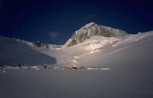 Camp 11000 is situated below the West Buttress. |
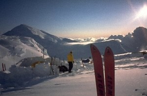 View outside the valley, the mountain at the left is Kahiltna Dome. |
Sunday, May 21, 2000
Camp 11000' - Windy Corner - Medical Camp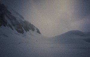
Shortly before Windy Corner
The weather improved yesterday afternoon, but it was a little late to leave for Medical Camp. So we get up at eight today and pack everything. Camp 11000 has a disadvantage: The sun doesn't rise before 9:15, therefore the mornings are a bit shady here. This morning we have -20°C, but the sky is clear and the winds calm.
In spite of the sunshine it takes some time until all our limbs are working well again. But soon a sweltering heat comes up.
Today we decide to take one of our two sleds with us: Everything that we cannot leave in Camp 11000' must be taken to our new home at Medical Camp. Still, we succeed in only 6 1/2 hours which is not a record time, but taking into account altitude and weight we are quite satisfied.
In Medical Camp we see Florian from Rosenheim in Bavaria and his Alaskan friends again; we had already met him on our flight to Alaska. So we soon get some help in building the snow wall for the tent.
Because of the good weather, we have an opportunity to look around and see - besides the landscape - many different types of people:
- oversize trucks (running up and down from camp to camp three times, because they apparently want to be installed here for several months. Often equipped with lots of completely unnecessary gear)
- incredible racers (making the way in three hours)
- technical specialists (need two complete re-arrangements of all the gear on the sled after every rest, because the draft lines are entangled.)
- more or less successful ski alpinists
- the "lemmings", popular everywhere (appear in large numbers behind an individual named "guide", always do exactly what he says, and have an unequalled skill to hopelessly block strategically important steeps or narrows. They are also easily identified by the uniform equipment throughout the group.)
Monday, May 22, 2000
Rest day in Medical CampThe altitude (4350 m) does not cause any problems for us during the nights, but our tent site lacks comfort. Anyway, today will be a rest day: First we should install our campsite a bit better, and second yesterday's trip was rather exhausting so we should recover a little.
The morning is cold, -25°C. During the day we have the apparently usual mixture of sun and clouds, so our tent gets sun rather late. Before, every move is risky: the frozen water trickles down from the tent walls onto us and our sleeping bags. Generally it is not too comfortable inside the tent, with all the food supplies.
The heat capacity of a tuna can is huge: It needs almost the whole day in the sleeping bag or in our clothes before it becomes a little more accessible. Final success is reached only after we immersed it in hot water. But, good food is of essential value here. Some crackers with tuna and mayonnaise at least give us some calories, and also the salami and the cheese from the supermarket in Anchorage are good additions to boring high-camp food.
Tuesday, May 23, 2000
Medical Camp - West Buttress - High CampThe morning is foggy in Medical Camp. The rangers' weather forecast promises improvement: today cloudy with sun, tomorrow above 17000 ft sunny. At noon we are on our way, with our small high camp tent and everything we need for staying overnight and for the summit.
The first 400 height meters follow a 30° slope, the remaining 200 m are steeper (45°), with only a little snow on hard ice, but fortunately there are fixed ropes. Nevertheless this part seems endless; the warm boots are not made for steep climbing with crampons, so they become rather uncomfortable with time.
At four o'clock we reach the crest of West Buttress at an altitude of 4930 m. The route runs mostly along the left side of the ridge. There is no rock climbing but only snow; some passages are a little exposed. Although the height difference of the ridge is only 300 meters, it takes us more than two hours until we arrive at High Camp at 5230 m and pitch our tent in an unused shelter. Otherwise we would have to spend several hours building the snow walls. The evening quickly becomes very cold (-30°C), after the sun has disappeared behind the ridge.
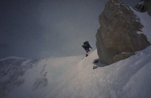 On West Buttress 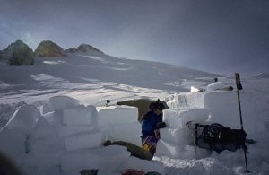 Our high camp at 5200 m |
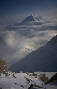 View to Mount Foraker |
Wednesday, May 24, 2000
Rest day in High CampThe weather forecast that the rangers gave yesterday morning was completely in vain. Nothing but white soup outside, and gusty winds. No conditions to find the way to the summit - or the way back, either.
In the small tent and in the cold environment, a rest day gives even less recovery than in Medical Camp. Meanwhile almost everything is wet, either by the condensed water that drops on everything during late morning, or by snow entering the tent when we open the entrance. We cannot put anything outside for drying because it would quickly be covered with snow.
What shall we do - descend, recover in Medical Camp and possibly try again after some days, or hold out up here in the cold, snowy, narrow high camp? After a long to and fro we decide to stay. Tomorrow we will give Denali a last chance to show itself at its best.
In the afternoon a Spaniard, having summited yesterday, visits us and gives us his remaining food supplies. Part of it is quite useful for us, but he could have taken out the garbage before.
Late in the evening, at half past eleven, we can admire Denali bathed in a reddish glow of dusk. The clouds have disappeared.
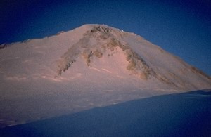
Late evening in high camp
Thursday, May 25, 2000
High Camp - Denali and backStill no clouds, and no wind. At half past seven the sun reaches our tent, and we leave at eight. Our packs are as lightweight as possible, the clothes thicker than ever before. The first part of the way - about two hours - leads towards Denali Pass through a shady slope. Often one has to climb a lot steeper than the average 35° of this slope due to séracs and crevasses - and at a temperature of -35°C it is uncomfortably cold here.
At Denali Pass (5560 m) we have a rest to defrost our feet in the sun. Fortunately the rest of the route continues in the sun. Mostly gentle slopes lead towards Archdeacon's Tower, then the route crosses a small saddle (5960 m) on its right side. (One of the first climbers of Denali was the Archdeacon of Alaska.) After a short descent we reach the boring Football Field. Meanwhile the usual afternoon clouds have replaced the outlook.
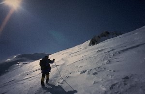
Sunny, at last
My speed decreases significantly at this altitude, probably exhaustion and the bad sleeping conditions in high camp. Claudia goes ahead; in case that I have to turn back, at least one of us can reach the summit. Having fought my way up the last steep slope, I reach the beginning of the summit crest at half past three. Quite a lot of people are already standing here.
After a close look at the first bump of the crest I join them and define the summit as practically reached. So this is Denali, 6193 m, North America's highest mountain. Unfortunately one can only see about 20 meters of all of North America.
The proper summit is about 30 meters higher, but the snow crest leading there is an abnormally steep shape. Its top gives space for only putting one foot there, both sides drop off steeply into the nowhere. And, there is no panorama to look at, just fog. Therefore, for most people the climb is done here on Kahiltna Horn, which is a little higher than indicated on the map: the main summit is definitely less than 60 meters higher.
After 15 minutes, Claudia comes balancing back over the crest from the main summit. Since still the view is no further than a couple of meters, we begin our way back soon. At least we could have a look to the further scenery during the ascent this morning.
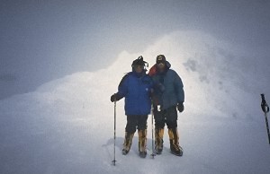
On Kahiltna Horn
The twenty meters of re-ascent behind Football Field are a very special pleasure, of course. The slope below Denali Pass is now in the sun (although the sun is quite milky meanwhile) and is not a serious obstacle if traversed with the given care. Those twenty meters up to our tent site again are tedious, however. Shortly after six in the evening we are back in our "mini home".
One member of the Seven Summits Expedition from Kazakhstan that also summited today is Juri, whom we know from Khan Tengri.
Friday, May 26, 2000
High Camp - Medical CampEven if it would have been very exhausting, it would have been a better decision to complete the descent to Medical Camp yesterday. This morning we have no milky sun, but a white something with stormy winds that shake our tent. Going down the exposed West Buttress with the heavy packs is not a very motivating prospect. So we wait, during the last days the storm generally died down a bit during the afternoon.
Indeed the storm becomes weaker, and at 2 pm the sun comes through. Packing all our stuff takes a while, since tent, sleeping bags and almost everything else is snowy and icy. Meanwhile the wind has intensified again, but now it comes from the north - the first time since we are here.
The way on the ridge is not a serious problem; the cold and the biting wind are tiresome, but one can maintain the balance well even during the exposed portions. And we have quite a good view to the landscape around us which we weren't given before. Mount Hunter shows its double summit, the huge Kahiltna Glacier is lying underneath us, and to the north we can imagine the hills of central Alaska.
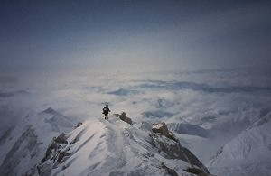
On the way back on West Buttress - finally there's a view.
After two hours we are back again on our small estate at the rim of McKinley City.
Saturday, May 27, 2000
Medical Camp - Base Camp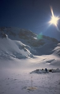
Medical Camp
The big tent is really comfortable, and down here there is clearly more air and less cold. Lazy as we are, we wait for the sun and get up as late as 9 am. During breakfast, we clearly violate one of the Denali behavior rules: Never put bread directly on the sleeping bag. It will freeze to the textile surface.
An almost cloudless sky allows us to see the wide view from Medical Camp for the first time. The extent of the glaciers is impressive, from here to the horizon one only sees white peaks.
At noon we begin our way down to Base Camp /"Airport". Down to Camp 11000' we have "only" our well-filled packs and one sled; there we have to pick up our skis and the contents of our cache.
Compared to two weeks before, immeasurable numbers of people are on their way here now. Does the proper season begin not until right now? Or is it just impossible to foresee what the weather will be like?
For the rest of the way, each of us have to take a sled. We soon fail trying to overcome the steep slope - the sled always wants to take a different direction, passes and destroys the delicate balance of us on skis with the heavy backpack.
Even on foot it is not too easy, the trace is lousy here. It must have snowed a lot the last days. As the slope decreases on Kahiltna Glacier, I remember a hint that an American guide gave me: tying a sling of rope around the sled at a right angle to the pulling direction makes it slower. This indeed works, the sled even stays under control down the steep Ski Hill.
Though we can enjoy a good view with nice weather, it is a long way (22 km) until we reach the junction at Southeast Fork Kahiltna Glacier. There, the real misery begins: Heartbreak Hill, the 150 height meters up to Base Camp, takes 1 1/2 endless hours. At eight o'clock we arrive, are soon welcomed, installed and invited to diner in Annie's tent. There are also two Alskans and two Australians, who have also come from Medical Camp today. So we don't even need to torment our stove, and we can hear some interesting stories. For example there is the one about the mountaineer who, descending from the high camp after the summit, wanted to trade his remaining fuel (which nobody likes to carry down again) for the same amount of freshly pressed orange juice. Since he refused to take juice from concentrate, he carried his fuel all the way down.

Mount Hunter, shortly before midnight
Sunday, May 28, 2000
Base Camp - Talkeetna (Flight)We can leave the Base Camp with the very first airplane. In perfect weather, the flight through the glacier landscape, often directly above the mountain crests, is a great adventure.
Meanwhile, it is really warm in Talkeetna. After check-out at the ranger station 1 we transform the bunkhouse of the flight company into a battlefield. All the wet stuff (and practically everything is wet or frozen) needs some time on the clothes-line.
For dinner, we get a respectable steak and - after longer renunciation - one, two good beers in the "West Rib". Besides this, we experience the return to American civilization: Drinks machines cannot count, or they like to eat coins without returning anything, and a phonecall home using coins is simply impudent. After the operator told me that he'd like to have an incredible eight dollars for a call to Germany, he really could have given back my quarter dollar.
With a calling card, it is a lot cheaper, but we hadn't found an opportunity to buy one before.
1 The success rate of the season at Denali at that time was only 21%, according to the board there.
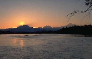
Sunset behind Mount Foraker; right side Hunter and Denali.
Monday, May 29, 2000
Talkeetna - Anchorage (van)Slept long, washed the clothes and enjoyed the view of Mt. Foraker, Mt. Hunter, and Denali (still 100 km distant). There's quite a lot of tourists in Talkeetna now, bus after bus enters the town. To us, it remains a complete mystery what an attraction this village in the swamps can offer, except that people - for example us - fly to Denali's basecamp from here, and there are also sightseeing flights. The latter, however, are less profitable than mountaineers for the flight companies.2
The question remains what all these people are doing here. Apparently they just come here, buy souvenirs and go back.
The shuttle van picks us up on time at 4 pm, and at 7.30 we are back in Anchorage.
2To fill a plane, only two or three mountaineers are needed, and the rest of the space is needed for the gear and baggage. A plane takes four or five "normal" tourists, in contrast. About prices, see the info page.
This is the end of the real Denali expedition.
Since we had planned for four weeks, of course we don't fly back home right now. Instead, we will travel around through Alaska for the remaining two weeks. The alpinistic aspects will be reduced to some half-day hikes, but nevertheless it shouldn't be boring.
Content of the second part:Bicycle tour from Anchorage to Seward · whales and other wildlife around Seward · train ride back to Anchorage · Denali National Park · Dalton Highway from Fairbanks to beyond the Arctic Circle (by car) · back via Delta Delta and Glennallen to Anchorage |
To the second part |
Home |
Back to "Mountains" |
Back to Expeditions |
Map sketch |
Height diagram |
Info Denali |
Part 2: Alaska |
 Slideshow |
Deutsche Version |
Hartmut Bielefeldt
Sonnhalde 8
D-88699 Frickingen
© 2000 Hartmut Bielefeldt
![]() This page is confirmed to comply with the HTML 4.0 standard.
This page is confirmed to comply with the HTML 4.0 standard.
Last updated September 26, 2000 by Hartmut Bielefeldt