| Home |
| Mountains |
| Expeditions |
| Ladakh 2014 |
| Map |
| Height Diagram |
| Info |
| Slideshow |
Home |
Back to "Mountains" |
Back to Expeditions |
Ladakh 2014 |
Height diagram |
Info |
Deutsche Version |
Ladakh 2014 - Map sketch

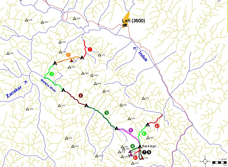
This map sketch (click to view a larger version) shows the 12 days of out Markha Valley trekking, the single days are color-coded. I have redrawn the crests, rivers and summits based on the Olizane map; for details about this map see the practical hints page.

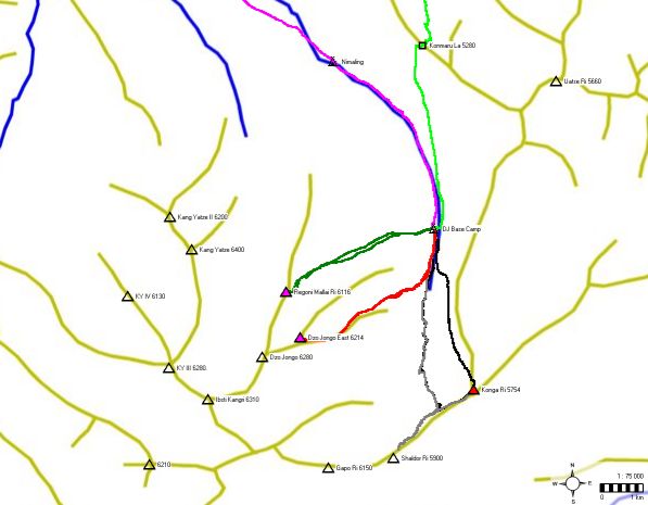
Enlarged view of the area around Dzo Jongo Basecamp.
Home |
Back to "Mountains" |
Back to Expeditions |
Ladakh 2014 |
Height diagram |
Info |
Deutsche Version |
![]() This page is confirmed to comply with the HTML 4.0 standard.
This page is confirmed to comply with the HTML 4.0 standard.
Last update February 08, 2015 by Hartmut Bielefeldt