| Home |
| Mountains |
| Expeditions |
| Tien Shan 98 |
| Map |
| Height diagram |
| Info |
| Slideshow |
Home |
Back to "Mountains" |
Back to "Expeditions" |
Trip report Tien Shan 95 |
Height diagramm 95 |
Trip report Tien Shan 98 |
Height diagramm 98 |
Deutsche Version |
Map sketch central Tien Shan
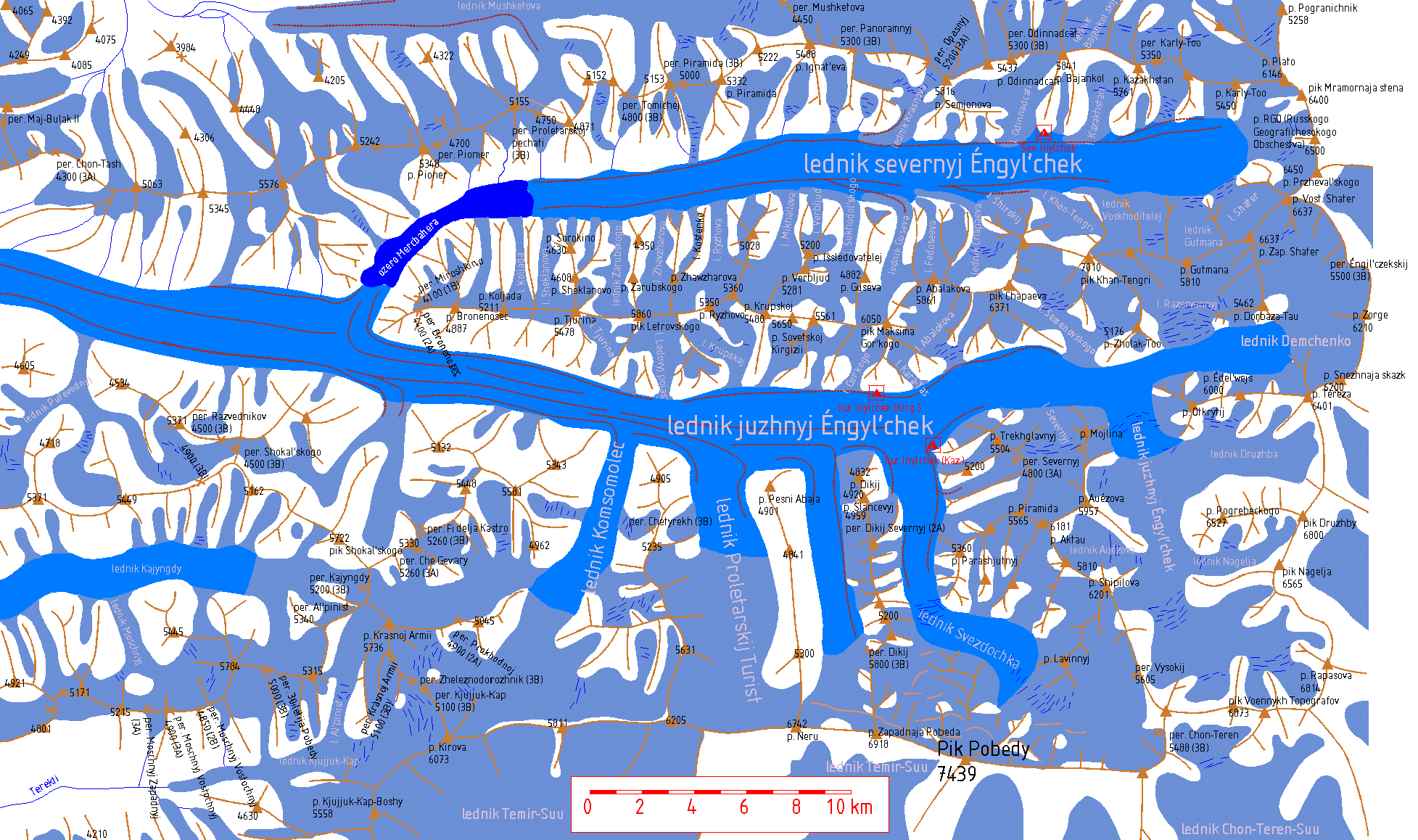
 Mountain crest with summit, summit height, and pass Mountain crest with summit, summit height, and pass | ||
 Glacier Glacier |  Large valley glacier Large valley glacier |  Lakes and rivers Lakes and rivers |
 Crevasse zone (only the most impassable ones are indicated) Crevasse zone (only the most impassable ones are indicated) |  Moraine Moraine | |
The latin transscription is based on the following assignment:

Since the names were in handwritten Cyrillic, there might be some errors in the latin transscription.
Abbreviations and frequent names: p.=pik=peak, per.=pereval'=pass, lednik=glacier, severnyj=northern, juzhnyj=southern
Home |
Back to "Mountains" |
Back to "Expeditions" |
Trip report Tien Shan 95 |
Height diagramm 95 |
Trip report Tien Shan 98 |
Height diagramm 98 |
Deutsche Version |
![]() This page is confirmed to comply with the HTML 4.0 standard.
This page is confirmed to comply with the HTML 4.0 standard.
Last updated November 30, 2000 by Hartmut Bielefeldt