| Home |
| Mountains |
| Expeditions |
| Ecuador 2003 |
| Map |
| Height diagram |
| Info |
| Slideshow |
Home |
Back to "Mountains" |
Back to Expeditions |
Ecuador 2003 |
Height diagram |
Info |
Deutsche Version |
Map sketch of our climbing and cycling trip in Ecuador 2003
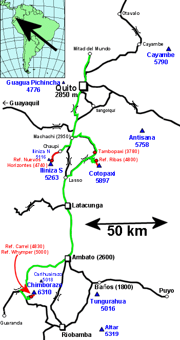
This map sketch is based on the Berndtsen&Berndtsen Ecuador Road Map 1:1000000. On the road network (black), our bicycle routes are shown in green. Mountain climbing tours are in red color.
The map is clickable; the links lead to the corresponding chapters in the trip diary.
Home |
Back to "Mountains" |
Back to Expeditions |
Ecuador 2003 |
Height diagram |
Info |
Deutsche Version |
![]() This page is confirmed to comply with the HTML 4.01 standard.
This page is confirmed to comply with the HTML 4.01 standard.
Last update 17 February 2003 by Hartmut Bielefeldt